 |
 |
|
 |
 |
 |
|
 |
 |
 |
 |
 |
|
 |
 |
 |
|
 |
|
A Hike to the Chinese Wall in the Bob Marshall Wilderness
Part 1 - Benchmark to Prairie Reef
Part 2 - The Chinese Wall
Part 3 - Larch Hill to Headquarters Pass
Part 4 - The South End of the Chinese Wall near Red Butte
Part 5 - The North End of the Chinese Wall near Larch Hill Pass
Part 6 - The Chinese Wall near Cliff Mountain
Part 7 - A Fall 2011 Trip Past the Chinese Wall
Part 8 - A Summer 2012 Excursion to the Chinese Wall
Copyright Notice
|
|
Welcome to Ear Mountain Photograpy
All images are available for purchase.
Take some time to view my photo galleries.
|
|
|
|
|
|
I've always wanted to see the Chinese Wall in the Bob Marshall Wilderness. If you are not familiar with this great feature it is a thousand foot high cliff of limestone that stretches unbroken for 12 miles between Haystack Mountain and Larch Hill Pass. A good trail runs along much of that stretch and I wanted to hike and explore the country there. The problem is that it is not just a walk along the base of the cliff. To reach the Wall I had to hike almost 20 miles to reach the saddle near Cliff Mountain where the trail begins to skirt the wall. Then the hike along the wall and over Larch Hill Pass would be another 7-8 miles. And finally I'd have to get back somehow. I decided to allot 6 days for the whole deal.
|
|
|
 |
|
Thursday September 25
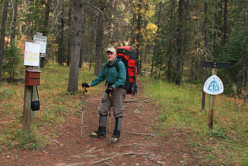
I began at Benchmark, a major trailhead west of Augusta, Montana. In order to see as much new country as possible I planned to exit at The Headquarters Pass Trailhead west of Choteau.
Nancy dropped me off and got this pic of me at the trail head. She would pick me up 6 days and 65 miles (for me) later.
|
|
|
 |
|
|
 |
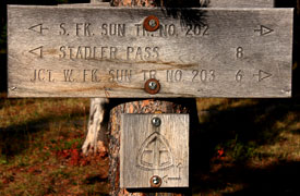
I headed up the trail, crossed the South Fork of the Sun River and reached the trail junction on the other side where the sign above told me I had to walk 6 miles to reach the West Fork trail that would take me to the Chinese Wall.
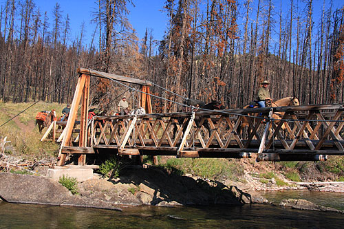
The 6 miles went quickly and I was soon enjoying lunch near the pack bridge over the West fork of the Sun when these fellows crossed over. These were the last folks I would see for almost 4 full days.
|
|
|
 |
|
|
 |
|
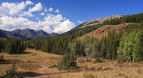
| While much of the forest along the South Fork of the sun River was burned by the Ahorn Fire, the West Fork of the Sun River features plenty of green trees and open prairies. My hike would eventually take me past Red Butte, the mountain in the distance in this pic. |
|
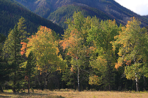 |
Aspen groves along the West Fork were just beginning to turn gold. By the time I finished my walk, 6 days later the trees were just about at the peak of color.
I hiked 4-5 miles up the West Fork and found a great camp near the river. There was a spur trail nearby that went to a lookout on the summit of Prairie Reef (8,868 feet). From that vantage point I could get a look around the country so I decided to camp two nights n one location spending the day off hiking up Prairie Reef.
I awoke at 4 and hit the trail a little after 5 hoping to reach a saddle at 7,500 feet and beat sunrise. A crescent moon was rising in the east but it provided little illumination. Walking in the dark with a head lamp on a trail I'd never hiked before was interesting. After leaving the valley the trail went up through large prairie areas. Elk were bugling and snorting in their fall mating rituals. I could hear their footfalls as the herd of elk moved away from the trail as I approached but I could not see them in the dark even with my head lamp. I could keep track of where they went though by listening to where the bulls were bugling.
|
|
|
 |
|
|
|
|
I reached the 7,500 foot saddle with only a few minutes to spare before the Chinese Wall, now visible in the distance, was lit up by the rising sun. I hung around there for over 90 minutes watching the sunrise, photographing the Wall and listening to the elk bugle. The view was very enticing and I looked forward to seeing the Chinese Wall up close. In the photo above Sphinx Mountain is on the left and Cliff Mountain is on the right. I planned to camp near Cliff Mountain on my third night. |
|
|
|
 |
|
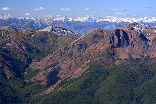
| A wider view of the Chinese Wall that includes Red Butte on the left. |
|
 |
|
After the sunrise I continued up the trail toward the lookout on the summit. The view kept expanding. Soon I could see west over White River Pass all the way to the snow covered peaks in the Swan Range. Larches (called tamaracks by the locals) were gold in their fall color. |
|
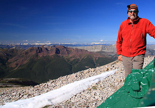 |
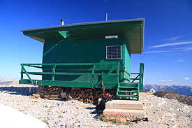
After another hour or so of hiking I popped out of the trees and could see the lookout far above me. The trail meandered through high alpine desert and I soon reached the lookout. A cold breeze chilled me pretty good. So I put on a warm jacket then enjoyed the view. |
|
|
 |
|
|
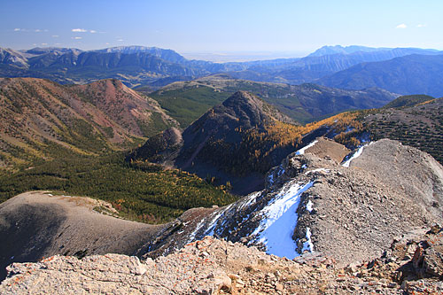 |
This view looks east. The low point is where the Sun River leaves the mountains. To the left of the gap is Castle Reef and on the right is Sawtooth. I can see both these mountains from my living room.
Here's a little quiz:
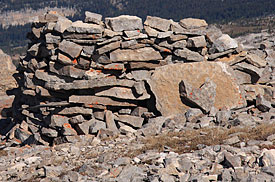
What is this structure that I discovered on Prairie Reef. I won't give you the answer but if you mouse over the image you will get a clue.
|
|
|
|
 |
|
|
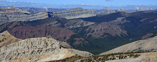 |
From the summit I got an even longer view of the Chinese Wall. Cliff Mountain, above where I would eventually camp, is in the center of the photo. |
|
| After spending more than an hour on top I began the long descent to the valley floor and my camp. Returning to the saddle there were still good views of Red Butte and the Chinese Wall.
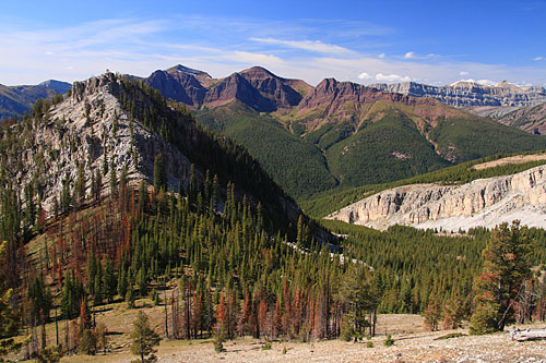
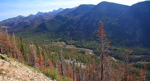
After passing the saddle where I photographed sunrise everything I passed was new since I had hiked up through there in the dark and saw nothing but the trail tread directly in front of me. Coming round the mountain I got fantastic views to the valley floor. I could see the grove of trees where I camped but my tent was not visible.
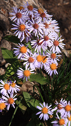
Some of this forest had burned last year but new flower growth brought color to the landscape.
|
|
|
 |
|
|
 |
|
|
 |
|
|
|
|
|
|
|
|
|
|
|
|
|
|
|
|
|
|
|
|
|
|
|
|
|
|
|
|


