Another Chinese Wall Adventure!
Eight Days in the Bob Marshall Wilderness of Montana
September 16-23, 2011
Part One - Benchmark to Prairie Reef
Part Two - The Snow Storm near Cliff Mountain
Part Three - Photography and Beauty along the Wall
Part Four - My Lake to Headquarters Pass Trailhead
Copyright Notice

My good friend Jim Utsler is a very talented artist. He wanted to get more inspiration and photographs for his work Since he had never been to the Chinese Wall in the Bob Marshall Wilderness we both thought that would be a good place to visit. Our adventure lasted 8 days. We saw some beautiful scenery in early fall colors, heard elk bugling in mountain meadows and experienced the seasons first big snow storm.
What a great trip it was.

Photos by Ralph Thornton and Jim Utsler.
To see Jim's fantastic art visit his Art by Jim Utsler website.

More Chinese Wall Stories click HERE

Regular visitors will remember my earlier trips to the Chinese Wall. One in 2008, another last July when I photographed the Chinese Wall from the top of Red Butte, and finally two trips to the the Wall in late 2011.

Don't remember those trips? Here's links to them:
2008 Hike to the Chinese Wall
A view of the Chinese Wall from Red Butte
The North End of the Chinese Wall.
A Late Fall Trip to the Chinese Wall.

This year Jim and I planned to spend 8 days on a one way trip from Benchmark to the South fork of the Teton River.

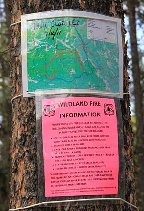
Right at the start we were a little nervous about the fires burning in the Bob and the various trail closures. But the weather cooperated. A little rain and snow put down the fires and we had little smoke to impact our photos.

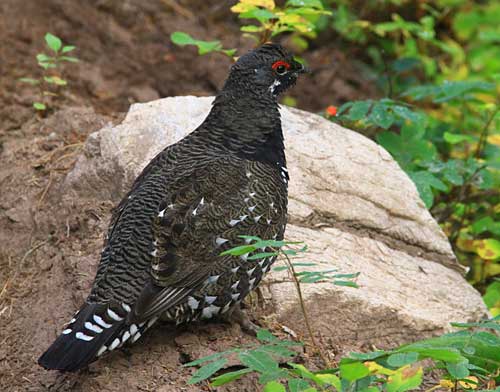
Not long after leaving the trailhead Jim photographed this grouse.

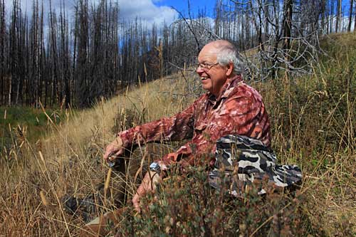
Left: Jim enjoying a luncheon along the West Fork of the Sun River.

We saw quite a few folks on this early fall trip including this Forest Service pack string.
One of my favorite views of the West Fork of the Sun River is this big meander a mile or two above the West Fork pack bridge.
Another of my favorite views is this scene of a meadow in fall color with Red Butte in the distance. I call the spot Red Butte Meadow. Look through my other Chinese Wall trips to see this same spot in other seasons.
After spending the night in camp along the West Fork of the Sun River, our plan for the second day was to explore Prairie Reef. The trail to the lookout gains over 3,300 feet in 4.7 miles.

Left: Sunrise on Red Butte as seen from our camp.

Jim closes up the door on his side of the tent just before we began our hike up Prairie Reef.
The trail gains elevation quickly providing some wonderful views. White River Pass and Red Butte are the backdrop for this view.
Left: The trail seemed to be heavily used by elk as these tracks confirm.

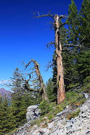
Right: Two old monarchs along the Prairie Reef trail.

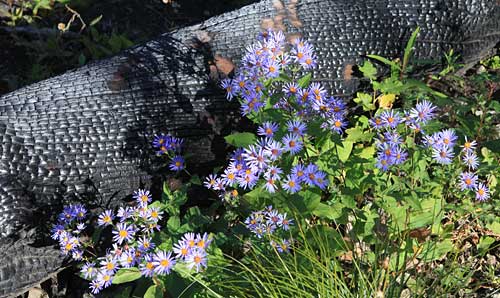
Purple Aster (?) growing along a log burned in the 2007 Ahorn Fire.
After a loooonnnnggggg walk the Prairie Reef summit with its fire lookout came into view.
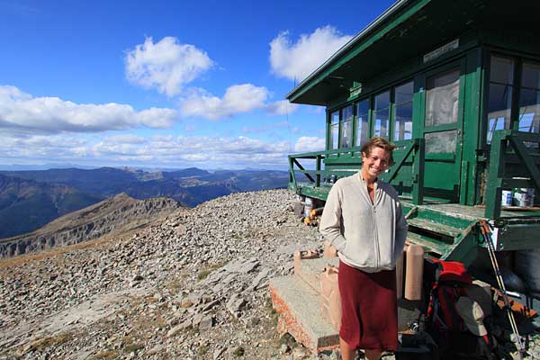
It was late in the season but because of the warm dry conditions Kelly was extended for a few weeks into fall. She graciously invited me in for some delicious coffee.

We had some nice conversation and the time passed too quickly.

The view from the top of Prairie Reef is stunning. I grabbed a few photos, including the one of Kelly above.

This view looks north toward Slategoat Mountain.

This view includes Reef Creek and the valley of the West Fork of the Sun River in the smoky distance.

It was now getting quite late. I bid Kelly goodbye and made the long descent to camp as quickly as possible.

Click below for:

Part Two