A Four Day Trek to Climb Slategoat Mountain (8,887 ft.)
in the Bob Marshall Wilderness of Montana June 27 - 30, 2013 Ccopyright Notice We tried this climb last year but only reached high camp. Too much snow and rain on climbing day prevented us from reaching the summit. So we had to try again. This time we were successful. |
||||||||||||
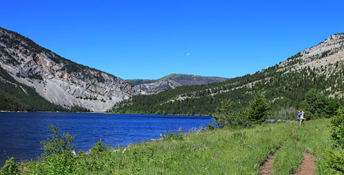
Our first day included a pleasant walk along the Gibson Reservoir west of Augusta, Montana. | |||||||||||||
Once past the head of the reservoir we crossed the North Fork of the Sun and headed south. We soon entered the Bob Marshall Wilderness. | |||||||||||||
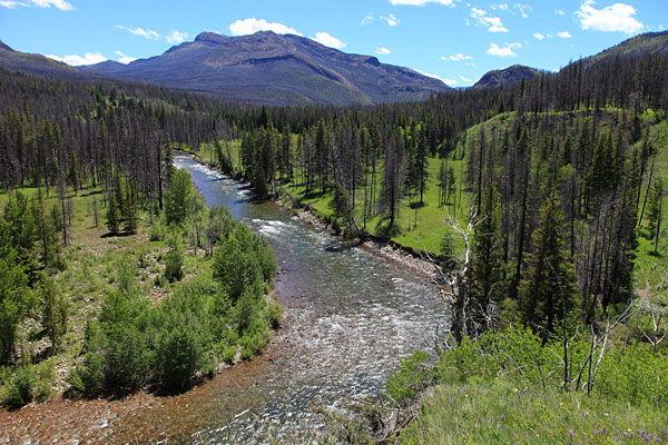
The trail climbed over a grassy knoll to reach the South Fork of the Sun River. | |||||||||||||
The South Fork of the Sun River near the confluence with Bear Creek. We had planned to camp near the spot where I took this photo but we found an elk carcass nearby that had been only partially consumed by various critters. We decided to move on. | |||||||||||||
After another mile and a half of hiking up the Bear Creek trail we found this pleasant spot near a stream to camp.
The next day we continued up Bear Creek to the Junction with the unmaintained South Fork Glenns Creek Trail. |
|||||||||||||
After following the South Fork Glenns Creek Trail and climbing to a high saddle above Bear Creek, we left the trail and headed down to the creek for water. This day brought hot weather that lasted the rest of the trip. We pumped water often. | |||||||||||||
After more than a mile of bushwhacking up the South fork of Glenns Creek we found this delightful spot to camp. | |||||||||||||
Left: Day Three and April ready for the climb of Slategoat Mountain. | |||||||||||||
We ascended easy slopes above camp to gain about 1,000 feet. | |||||||||||||
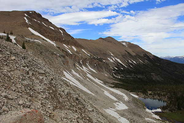
Slategoat Mountain lies at the north end of a long ridge that has many smaller peaks. We climbed to the saddle immediately above camp, then headed north. | |||||||||||||
Resting at the saddle Ron enjoys the view of the Chinese Wall to the west. | |||||||||||||
Left : Walking along the ridge leading to Slategoat.
Below:Our first real challenge was climbing this high knob. Another 1,000 feet of gain. |
|||||||||||||
Above: The summit of Slategoat is at the right end of the long ridge.
Left" April and I approach the top of the knob. The views began to get really nice. |
|||||||||||||
OK then, we walked a long way on the ridge and spotted a huge cairn on the ridge ahead. That must be the summit.
It didn't seem to be that far ahead. So we spent some time looking around. |
|||||||||||||
Above: Looking north toward the Three Sisters and Redhead Peak. (See the ChoteauCam page for a trip to those peaks.)
April on the Ridge with the summit of Prairie Reef in the distance. There is a lookout on Prairie Reef and that summit is the highest point in the Bob Marshall Wilderness reachable by trail. |
|||||||||||||
Ron and April ascend and interesting pitch of sloping ledges covered with loose rock. | |||||||||||||
Eventually we reached the big cairn only to discover this was a false summit. The top of Slategoat was another half mile further on the ridge. | |||||||||||||
And a storm was approaching! We spent only about 20 minutes on top eating a snack and putting on raingear. Lightning flashed in the distance so we quickly began our descent.
The rain came while we were still on top. But it quick right after we left the summit. A little wind, a little more rain and the storm passed to our south. Phew! |
|||||||||||||
Above: Looking south along the ridge to the Prairie Reef lookout.
Left: April heading back to camp. |
|||||||||||||